|
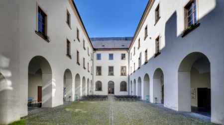
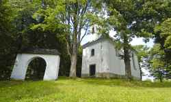
aktuálně -5.7 °C zataženo 04.02. | zataženo | 1.8 °C 05.02. | zataženo | 1.9 °C 06.02. | slabý déšť | 3.5 °C | Sternberg MonasteryThe former Augustinian monastery offers trips into history through experiential tours, enlivened by playing musical instruments or a puppet show.The tour takes you through the majestic complex, including the historic halls and cellars, and introduces you to paintings by Baroque masters, the history of the town of Sternberg and the monastery itself, and seasonal exhibitions. The tour concludes with a demonstration of organ playing in the adjacent Church of the Annunciation. Together with the parish church, the monastery is the most important Baroque architecture of Sternberg, although their history dates back to the 14th century. In the monastery you will also find a separate multimedia exhibition Ecce Homo Park, presenting the history and present of the famous hill climb car race. 0%
| ||||||||||||||||||||||||||||||||||||||||||||||||
The system of interactive links for individual records in selected modules within the project Central Moravia - mainly quiet (2024) was implemented with the support of the state budget of the Czech Republic from the programme of the Ministry for Regional Development.
The optimization of the website and the online campaign within the project Adrenalin after ours (2023) were realized with the contribution of the state budget of the Czech Republic from the programme of the Ministry for Regional Development.
The website was created within the framework of the project Marketing TO Central Moravia 2020 implemented with the contribution of the state budget of the Czech Republic from the programme of the Ministry for Regional Development.
The operation and activities of Střední Morava – Sdružení cestovního ruchu (Central Moravia – Tourism Association) were supported by funds from the Czech Republic's state budget under a program of the Ministry of Regional Development of the Czech Republic.
