 aktuálně 16.0 °C polojasno 04.07. | zataženo | 21.0 °C 05.07. | zataženo | 19.1 °C 06.07. | zataženo | 21.3 °C Adresa: Osek nad Bečvou Okres Přerov, Olomoucký kraj Česko | Contact:
Osek nad Bečvou, Česko
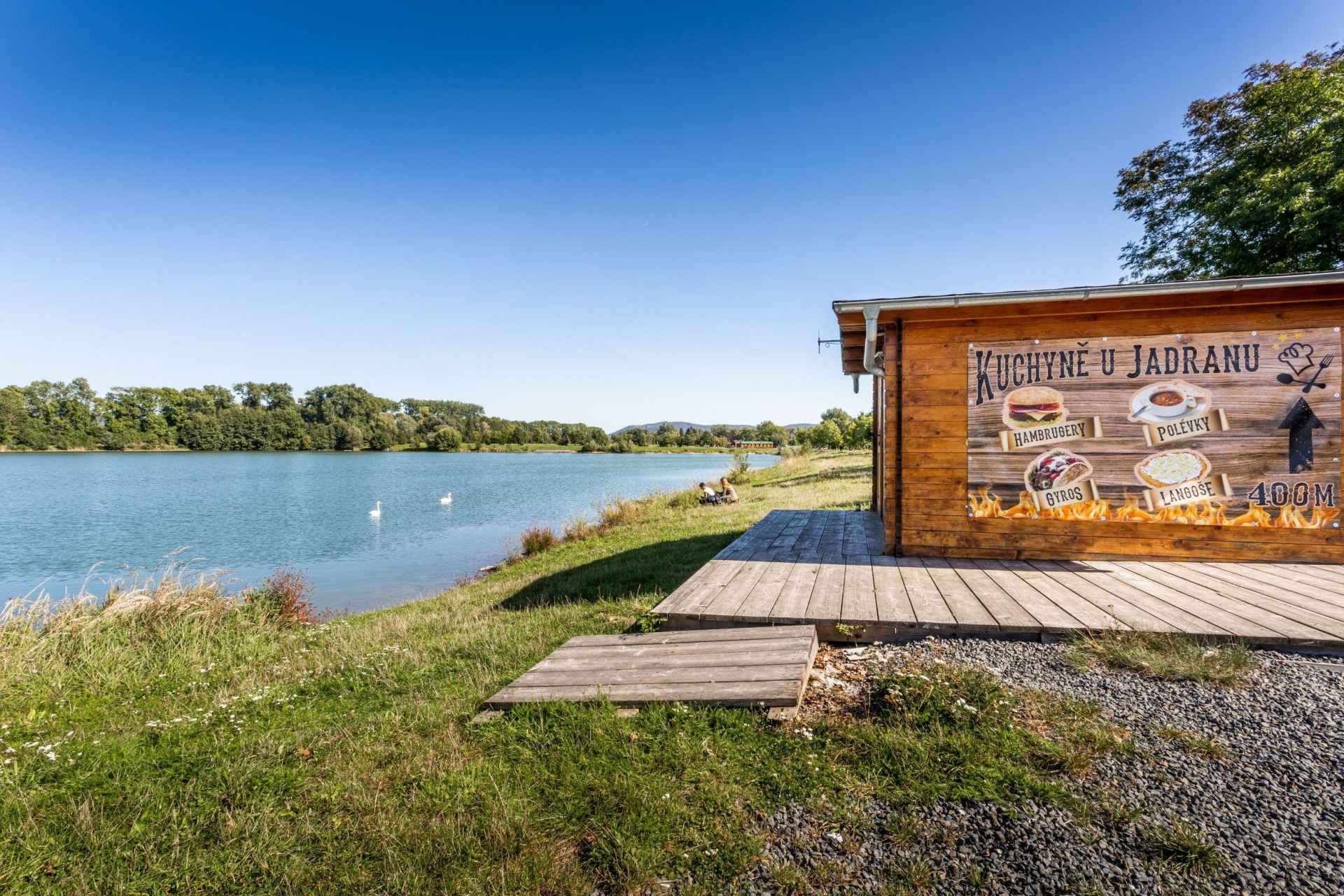
Plan route Sand plant JadranGo for summer refreshment offered by the natural swimming pool Jadran in Osek nad Bečvou. Its name is mainly due to its clear blue water, reminiscent of the Adriatic Sea.The swimming pool is surrounded by grassy beaches with easy access to the water, and the beach facilities include refreshments, a playground and sanitary facilities. The Bečva cycling path, which crosses the Olomouc and Zlín regions, also runs close to the swimming pool and offers many interesting stops for cyclists. The swimming pool can be a great place to spend hot summer days for families with children or a pleasant stop for cyclists and skaters. 0%
| ||||||||||||||||||||||||||||||||||||||||||||||||


The system of interactive links for individual records in selected modules within the project Central Moravia - mainly quiet (2024) was implemented with the support of the state budget of the Czech Republic from the programme of the Ministry for Regional Development.
The optimization of the website and the online campaign within the project Adrenalin after ours (2023) were realized with the contribution of the state budget of the Czech Republic from the programme of the Ministry for Regional Development.
The website was created within the framework of the project Marketing TO Central Moravia 2020 implemented with the contribution of the state budget of the Czech Republic from the programme of the Ministry for Regional Development.
The operation and activities of Střední Morava – Sdružení cestovního ruchu (Central Moravia – Tourism Association) were supported by funds from the Czech Republic's state budget under a program of the Ministry of Regional Development of the Czech Republic.