|
aktuálně -3.7 °C zataženo 02.02. | zataženo | -2.3 °C 03.02. | mírné sněžení | -1.4 °C 04.02. | zataženo | -0.5 °C | Contact:
798 45 Lipová, Česko
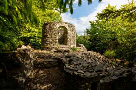
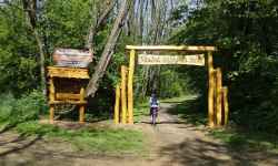
Plan route Hrádek Lipová (Špacírštejn)It took about 10 years of work for an enthusiastic pensioner, Mr. Procházko, to build the castle with his own hands, which gives the impression of a historical ruin.The idea was born in 1975, when Mr. Procházka, as an enthusiastic mushroom picker, began to notice the half-demolished stone walls in the surroundings, which were once built by local farmers. He wanted to build on their legacy, and so in 1982, he began bringing hundreds and hundreds of buckets of stones to the site of the planned construction. Today, dozens of curious day-trippers come to the stone rotunda to see the unusual feat. Thanks to this fact and Mr. Procházka's surname, which in the German infinitive sounds like "spazieren", the castle is nicknamed Špacírštejn.
0%
| ||||||||||||||||||||||||||||||||||||||||||||||||
The system of interactive links for individual records in selected modules within the project Central Moravia - mainly quiet (2024) was implemented with the support of the state budget of the Czech Republic from the programme of the Ministry for Regional Development.
The optimization of the website and the online campaign within the project Adrenalin after ours (2023) were realized with the contribution of the state budget of the Czech Republic from the programme of the Ministry for Regional Development.
The website was created within the framework of the project Marketing TO Central Moravia 2020 implemented with the contribution of the state budget of the Czech Republic from the programme of the Ministry for Regional Development.
The operation and activities of Střední Morava – Sdružení cestovního ruchu (Central Moravia – Tourism Association) were supported by funds from the Czech Republic's state budget under a program of the Ministry of Regional Development of the Czech Republic.
