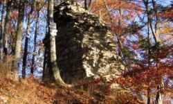
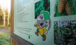
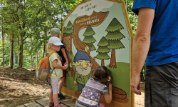
Exposition about the history of Potštát
Záznam není přeložen
aktuálně 16.9 °C oblačno
25.07. | slabý déšť | 22.4 °C
26.07. | slabý déšť | 21.8 °C
27.07. | déšť | 14.7 °C
Adresa:
Zámecká 1
75362 Potštát
Přerov, Olomoucký kraj
Česko
Naplánovat trasu

Contact:

581 624 275
Zámecká 1
75362 Potštát, Česko
Plan route

Exposition about the history of Potštát

The Municipal Museum is located in a Renaissance chateau in the centre of Potštátu and since 2014 it has been offering visitors a unique exhibition about the history of the town and the whole Potštátu region. The exhibition guides visitors through history from the period of the Walderode family, through the dramatic events of World War II and the displacement of the inhabitants, to life after 1989. Particular attention is paid to the extinct villages on the territory of the Libavá military unit, which formed an important backdrop to the region.

The exhibition is divided into three parts:
Historical pearl in the green - about the Walderode family, monuments and nature in the surroundings.
The turning point - the war, the displacement, the establishment of the military convoy and the decline of the region.
Awakening against the odds - the efforts to rebuild the town and life under communism.

The exhibition is made up of period photographs, objects and personal stories, including a "report from history" by Dr. Krška. It offers powerful experiences and insights and sensitively captures difficult moments in the region's history.

0%
The Potštát Rock Town Nature Trail

The Potštát Rock Town Nature Trail

Take a trip to Potštát and discover the extraordinary rock town - an area of rock formations shrouded in deep forests, among which the ruins of Puchart Castle are hidden. Each rock here has its own ... (more)
Obtížnost: středně těžká
Čas: 158 minut
Délka: 11.86 km
Zážitek:
Stoupání: 404 metrů
Klesání: 408 metrů
Krajina:
Nejvyšší bod: 568 m.n.m.
Nejnižší bod: 357 m.n.m.
Študent

Študent

The Student's Forest Nature Trail in Bohuslávky leads through the local forest Obora. It starts at the tourist shelter next to the road from Bohuslávky to Dolní újezd. There are 5 stops along the ... (more)
Obtížnost: lehká
Čas: 21 minut
Délka: 1.59 km
Zážitek:
Stoupání: 29 metrů
Klesání: 29 metrů
Krajina:
Nejvyšší bod: 312 m.n.m.
Nejnižší bod: 283 m.n.m.
Bee nature trail

Bee nature trail

The nature trail offers tourists basic information about beekeeping and everything related to it. You will get to know the daily life of the bee colony itself and learn how bees live in hives and how ... (more)
Obtížnost: lehká
Čas: 32 minut
Délka: 2.40 km
Zážitek:
Stoupání: 11 metrů
Klesání: 19 metrů
Krajina:
Nejvyšší bod: 248 m.n.m.
Nejnižší bod: 239 m.n.m.
Nature trail Around the Hranice Abyss

Nature trail Around the Hranice Abyss

Between the villages of Hranice and Teplice nad Bečvou lies a unique area made up of primordial limestone - the Hůrka u Hranic National Nature Reserve. The nature trail that crosses it introduces to ... (more)
Obtížnost: středně těžká
Čas: 25 minut
Délka: 1.90 km
Zážitek:
Stoupání: 97 metrů
Klesání: 93 metrů
Krajina:
Nejvyšší bod: 318 m.n.m.
Nejnižší bod: 256 m.n.m.
The Bečva cycle path

The Bečva cycle path

The undemanding regional section of the cycle path along the Bečva River is designed not only for cyclists, but also for pedestrians and, where the road surface allows it, for skaters.   It star ... (more)
Obtížnost: lehká
Čas: 298 minut
Délka: 82.86 km
Zážitek:
Stoupání: 380 metrů
Klesání: 471 metrů
Krajina:
Nejvyšší bod: 324 m.n.m.
Nejnižší bod: 194 m.n.m.
Nature trail Škrabalka

Nature trail Škrabalka

The nature trail leads through the Škrabalka Nature Reserve, and introduces visitors to the formation of the blind arms of the river and the local fauna and flora. More than 220 species of higher pla ... (more)
Obtížnost: lehká
Čas: 8 minut
Délka: 0.60 km
Zážitek:
Stoupání: 5 metrů
Klesání: 5 metrů
Krajina:
Nejvyšší bod: 228 m.n.m.
Nejnižší bod: 226 m.n.m.
Nature trail Valšovice

Nature trail Valšovice

The nature trail leading through the forest paths will introduce you to the work of a forester and forest nature. The starting point is the building of the School Forest near Hranice. The trail leads ... (more)
Obtížnost: lehká
Čas: 36 minut
Délka: 2.75 km
Zážitek:
Stoupání: 47 metrů
Klesání: 47 metrů
Krajina:
Nejvyšší bod: 420 m.n.m.
Nejnižší bod: 377 m.n.m.
Nature trail Černotín - Hluzov

Nature trail Černotín - Hluzov

The nature trail near Hranice introduces tourists to the attractions of the villages of Černotín and Hluzov and their surroundings. The starting point is the centre of the village of Černotín, whe ... (more)
Obtížnost: lehká
Čas: 135 minut
Délka: 10.18 km
Zážitek:
Stoupání: 221 metrů
Klesání: 186 metrů
Krajina:
Nejvyšší bod: 352 m.n.m.
Nejnižší bod: 250 m.n.m.
The Countess

The Countess

On the nature trail around Veselíčko you will walk through the places where the Countess herself walked. The trail presents the history and present in the village and its surroundings and has a tota ... (more)
Obtížnost: lehká
Čas: 74 minut
Délka: 5.61 km
Zážitek:
Stoupání: 10 metrů
Klesání: 20 metrů
Krajina:
Nejvyšší bod: 200 m.n.m.
Nejnižší bod: 100 m.n.m.
Educational trail of Hrubik the Elf

Educational trail of Hrubik the Elf

The Hrubík Nature Trail has 7 stops with educational and fun activities for families with children. It is about 1 km long and starts behind the stable building. The theme of the nature trail is th ... (more)
Obtížnost: lehká
Čas: 27 minut
Délka: 2.05 km
Zážitek:
Krajina:
Hrubíkův lesopark

Hrubíkův lesopark

Discover the forest park in the Hrubá Voda Resort, where children (and not only them) will enjoy adventure, movement and playful learning in nature. There is a 2 km long nature trail,large wooden bal ... (more)
Obtížnost: lehká
Zážitek:
Krajina:
Nature trail through the Bystřice Valley

Nature trail through the Bystřice Valley

The trail through the Bystřice River Valley and the Bystřice Valley Nature Park starts in Domašov nad Bystřicí and leads to Hrubá Voda. There are 10 stops along the route , along with informatio ... (more)
Obtížnost: lehká
Čas: 174 minut
Délka: 13.08 km
Zážitek:
Stoupání: 278 metrů
Klesání: 430 metrů
Krajina:
Nejvyšší bod: 546 m.n.m.
Nejnižší bod: 345 m.n.m.
The system of interactive links for individual records in selected modules within the project Central Moravia - mainly quiet (2024) was implemented with the support of the state budget of the Czech Republic from the programme of the Ministry for Regional Development.

The optimization of the website and the online campaign within the project Adrenalin after ours (2023) were realized with the contribution of the state budget of the Czech Republic from the programme of the Ministry for Regional Development.

The website was created within the framework of the project Marketing TO Central Moravia 2020 implemented with the contribution of the state budget of the Czech Republic from the programme of the Ministry for Regional Development.