|
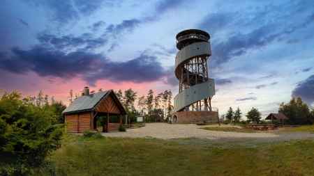
aktuálně -2.8 °C zataženo 04.01. | skoro jasno | -3.8 °C 05.01. | zataženo | -6.1 °C 06.01. | zataženo | -4.1 °C | Lookout tower Velký KosířThe lookout tower offers a breathtaking view of the entire panorama of the Haná lowlands, the Drahanská vrchovina and the Low Jeseník.
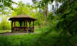
The lookout tower on Kosíř (442 m above sea level) is 28 metres high and a total of 158 steps lead up to its viewing platform, which is 25 metres high. There are toilet facilities and a souvenir shop nearby. There is also a wooden shelter where you can hide not only from the rain or from the harsh sun, you can also enjoy a fireplace with an always renewed supply of wood to light a fire and roast some marshmallows (in season they are available for purchase directly in the souvenir shop). Kosíř is a great option of a city getaway if you're visiting Olomouc and want to go on a little hike and see the local nature. 0%
| ||||||||||||||||||||||||||||||||||||||||||||||||
The system of interactive links for individual records in selected modules within the project Central Moravia - mainly quiet (2024) was implemented with the support of the state budget of the Czech Republic from the programme of the Ministry for Regional Development.
The optimization of the website and the online campaign within the project Adrenalin after ours (2023) were realized with the contribution of the state budget of the Czech Republic from the programme of the Ministry for Regional Development.
The website was created within the framework of the project Marketing TO Central Moravia 2020 implemented with the contribution of the state budget of the Czech Republic from the programme of the Ministry for Regional Development.
The operation and activities of Střední Morava – Sdružení cestovního ruchu (Central Moravia – Tourism Association) were supported by funds from the Czech Republic's state budget under a program of the Ministry of Regional Development of the Czech Republic.
